
Day 5: August 22, 2018
Route: Hunters, Washington, to Nakusp, British Columbia
I woke up around 7 a.m. and looked out the front of my tent to see a very nice sunrise over the lake. Smoke in the air had the side-benefit of warming the reds and oranges of the sunrise. Made my coffee while Greg was still sleeping and just sat and watched the stillness of the lake. The silence was beautiful. Soon Greg got up and we broke camp to head for Canada.
We checked Greg’s Butler Map to decide if we wanted to continue up Highway 25, or cross the Columbia River on the Inchelium-Gifford Ferry. The map labeled the Inchelium Highway as a “gold” road, meaning it was, as Greg called it “Motorcycle Heaven.” I made the choice that we would take the ferry and take the gold road.
We got on the ferry a little south of Gifford. The ferry crew allowed us to the front of the line so we would be first off. The ride on the Columbian Princess took about 10 minutes.

We headed north on Inchelium Highway toward Kettle Falls. While the road followed the river and had many wonderful views, it was not at twisty and “Motorcycle Heaven-ish” as the map made it out to be. It did not seem all that much different from the stretch of Highway 25 we had ridden yesterday between Fort Spokane and Hunters.


We passed through many areas that had been burned by recent fires. We also saw fire crews in the area doing their work to make sure the fires were out. We stopped for gas in Coleville at the junction of Washington Highway 20 and US Highway 395. While the pumps were open, the store was closed, presumably because of the fires. Burned trees and brush went right up to the back edge of the parking lot at the station.
We turned north on Highway 395 and headed for the border crossing at Laurier. Along the way, we passed through small timber communities that showed that logging was still alive and well in Northern Washington.

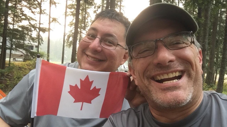
Laurier was definitely one of those towns that if you blinked you would miss it. It seemed that no sooner did I see the sign for Laurier, then I saw a giant maple leaf flag flapping in the breeze. There she was – Canada! Reaching the international border felt like a huge milestone for me. It hit me, I rode a motorcycle from California to Canada!

Crossing the border was quick and easy. The Canadian Border Services Agency agent was polite and didn’t delay us too much. I got my passport stamped (something you have to actually request) and I was sent on my way. We pulled over over a few hundred meters (we’re now using metric) past the border station to stop and take pictures and exchange handshakes at the sign welcoming us to British Columbia.


We headed north on BC Highway 395 for a few mile – er, kilometers – and turned onto BC Highway 3 toward Castlegar. We rode the shores of Christina Lake then climbed up Bonanza Pass in the Monashee Mountains.

We stopped in Castlegar for lunch. We tried to go to Tim Horton’s for my first visit. However, they were closed. There was a sign saying they were open during construction, but also a sign of unknown age saying they were closed for an employee party. We may never know the true reason, but if it was because of a party, I’m a little disappointed we weren’t invited. I thought Canadians were supposed to be polite. We ended up at A&W, another place we don’t have back at home. I ordered poutine, and found it to be quite good for fast-food poutine.

Castlegar was really smoky. I ended up putting on my N95 mask for the remainder of the trip. We hopped on BC Highway 3A which followed the path of the Kootenay River. At Brilliant, we passed an old suspension bridge that, looking back, I would have liked to have stopped and gotten a picture of. Some might say it was a brilliant suspension bridge.
At Playmor Junction, we turned onto BC Highway 6 for the final stretch to Nakusp. Highway 6 had everything you could want on a motorcycle – fast sweeping turns, tight twisties, and magnificent views (when you could see them through the smoke).
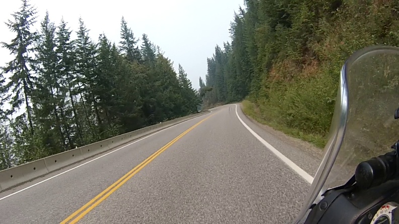
At a few places along Highway 6 the smoke was really bad. The N95 was helping a bit with sparing my lungs. We passed along one stretch of highway, north of Slocan along Slocan Lake, where the road was built into the cliff above the lake. The smoke was so bad I could not tell how far down the lake was, nor could I tell how high the cliff was above me. It was almost like I was riding a road in the sky, and was slightly vertigo-inducing. Below you can see the difference between a smoky day and clear day.


Now, here I was, at least 100 kilometers into Canada, and I had not switched my speedometer to metric. I had switched my GPS to metric, but it was almost impossible to see in the sun. The road signs gave a maximum speed of 100 km/h, but I didn’t know how fast that was. I was trying to do the conversion in my head, but grew tired of it and just went with the flow of traffic. One thing I did notice was, the distances seem to pass faster in kilometers as opposed to miles.

Soon enough, we were rolling into Nakusp. We headed for the municipal campground, where Greg’s friend, The Wookie, had already acquired us a campsite. We dismounted, stretched our legs, and said our hellos – we were here!
We set about putting up our camp, home for the next four days. While doing so, something happened that would end up being a common occurrence over the next few days. I hear a voice say, “Is that Greg?!” It seems Greg is fairly well known by other Horizons Unlimited attendees.
Now for a few days of relaxation, inspiration, and education.
Distance: 221 miles, 1,137 total.